You need to know if you can operate your drone, under what limitations, whether authorizations are required, and how to get those authorizations. Answers here!
TLDR:
The airspace in which you fly may be regulated or non-regulatory. For example, you can fly your drone in certain jurisdictions without authorization. In other cases, you may not be allowed to take off, land, or fly your drone without prior approval. Knowing the appropriate rules is a prerequisite for every drone pilot. It might mean the difference between a pleasurable drone flight and fines or imprisonment.
For the most accurate and up-to-date assessment of your proposed flight area, a drone pilot should use the definitive tools recommended by the respective regulator. Use the search function on this page to find your desired location (corresponding to the state, city, or country). In addition, we have provided links to the regulator-approved sites, tools, or maps identifying airspace restrictions for drone flyers in those locations.
Read on to find out how to stay on the right side of the law for all your drone flights.
Understanding Airspace Classifications
In the United States and many other jurisdictions, airspace is categorized as regulatory and non-regulatory. Controlled (Classes A, B, C, D, and E) and uncontrolled (Class G) airspace exist within these categories. The different airspace classes are defined based on the level of air traffic control services provided to flights.
Class A airspace is the highest level of controlled airspace, while Class G airspace is the least restrictive and uncontrolled.
The airspace classes have different requirements for pilot certification, equipment, and communication with air traffic control:
- Controlled airspace (Classes A, B, C, D, and E) requires pilots to have specific certifications, equipment, and communication with air traffic control.
- In Class A airspace, pilots must have an instrument rating and operate under IFR flight rules.
- In Class B airspace, pilots must have a private pilot certificate, a Mode C transponder, and two-way radio communication with air traffic control.
- In Class C airspace, pilots must establish two-way radio communication with air traffic control before entering the airspace and maintain communication while in the airspace.
- In Class D airspace, pilots must establish two-way radio communication with the control tower before entering the airspace.
- Class E airspace is controlled airspace that typically covers areas outside of airports and is designated to serve a variety of terminal or en route purposes. Pilots are not required to have specific qualifications, equipment, or operational procedures to fly in Class E airspace.
- Class G airspace, which is uncontrolled, has no specific pilot qualifications, equipment requirements, or operational procedures necessary.
Special Use Airspace You Should be aware of
Special use airspace consists of areas where specific activities must be confined to that area or where limitations are imposed upon other aircraft that are not a part of those activities. These areas are depicted on aeronautical charts, except for controlled firing areas.
- Prohibited areas exist where aircraft are not permitted to fly for security reasons or to protect national welfare.
- Restricted areas contain hazardous activities to non-participating aircraft, such as artillery firing, aerial gunnery, or guided missiles.
- Warning areas contain hazardous activities to non-participating aircraft and warn non-participating pilots of potential danger.
- Military Operation Areas (MOAs) contain military activities and separate certain military training from IFR traffic. VFR traffic may still fly through the area but should exercise caution.
- Alert areas inform pilots of high-volume traffic due to pilot training or unusual aerial activity.
- Controlled firing areas (CFAs) allow activity to occur in a confined area without creating a hazard.
- Temporary flight restrictions are short-term airspace blocks used to limit nonparticipating aircraft temporarily.
Other airspace includes airport advisory areas, air defense identification zones, military training routes, VFR flyways, VFR corridors, terminal radar service areas, national security areas, and U.S. Wildlife refuges.
Understanding Regulatory and Non-regulatory Airspace
Flying Indoors
In general, airspace regulations do not include indoor space. So typically, a drone pilot can fly drones indoors in buildings without regulators’ approvals. However, they will need the permission of the building owners before they can fly their drones.
Outdoors in the USA
In the USA and US territories regulated by the FAA, there is no “unregulated” airspace. Instead, the FAA uses the terms controlled and uncontrolled with specific rules applied to each.
Outdoors outside the USA
Other regulators may classify their airspace into regulated and unregulated/non-regulatory areas. The classifications roughly correspond to the controlled/uncontrolled categories used by the FAA.
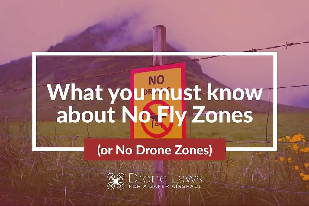
Understanding No-fly zones and No Drone zones?
What is a No-fly zone?
A no-fly zone, also called a no-flight zone or an air exclusion zone, is an area or territory set up by a military power where certain aircraft are not allowed to fly. No-fly zones are often set up for security or safety reasons, like to keep military operations out of an area or to protect civilians.
Drone operators and some regulators have recently started using this term to discuss places where drones can’t fly without permission.
What is a “No Drone Zone?
The FAA uses the term “No Drone Zone” to help people identify places where they cannot operate a drone or unmanned aircraft system (UAS). The operating restrictions for a no-drone zone are location-specific.
- Restricted Airspace: The FAA prohibits drone flight over certain areas of airspace.
- Local Restrictions: In some locations, drone takeoffs and landings are restricted by state, local, territorial, or tribal government agencies. The FAA has provided a No Drone Zone sign that these governments can use to identify areas with local flight restrictions. It is important to note these No Drone Zones only restrict taking off or landing and do not restrict flight in the airspace above the identified area.
- Temporary Flight Restrictions (TFRs) define a specific area of airspace where air travel is limited for a period and may be in place for different reasons. The FAA may use the term “No Drone Zone” to identify an area with a TFR. Examples include major sporting events, presidential movements, or in security-sensitive areas designated by federal agencies.
Violating a No Drone Zone can result in fines or criminal charges.
What is similar/different between a “No-fly zone” and a “No-drone zone”?
No-fly and no-drone zones are similar in that they restrict flying in certain areas. However, they differ in their scope and purpose. No-fly zones are areas where all aircraft, including drones, are prohibited from flying due to safety or security concerns. No drone zones, on the other hand, only restrict the operation of drones and do not necessarily prohibit other types of aircraft from flying in the same area. No drone zones are typically established to protect sensitive areas or events, such as airports, stadiums, or government buildings. To fly a drone in a no-fly or no-drone zone, you need to obtain authorization from the FAA or other relevant authorities responsible for managing that airspace.
I’m a drone pilot. What if I come across a ‘No Drone Zone sign?
A “No Drone Zone” sign tells you you can’t take off or land your drone in that area because it’s against the law. Even if you have airspace authorization to fly over this area, you are not permitted to take off or land from the property designated as a local no-drone zone. In other words, airspace authorization does not imply approval for land use.
It is essential to pay attention to these signs and follow the rules to avoid legal problems or safety risks. Always research and plan your drone flights beforehand to ensure there are no known no-fly zones in the area.
I’m a drone operator. How do I check for no-fly zones, no-drone zones, and uncontrolled or controlled airspace in the USA?
The FAA has partnered with several partners to develop B4UFLY mobile apps. Theses app can tell you if there are any airspace restrictions where you want to fly.
If you are looking for a drone no-fly zone map, then B4UFLY is a good place to start.
The app provides situational awareness to recreational flyers and other drone users. You will need airspace authorizations to fly in controlled airspace. This app does not allow you to get airspace authorizations. Authorizations are available through the FAA’s Low Altitude Authorization and Notification Capability (LAANC).
The B4UFLY app is available to download for free:
B4UFLY Desktop and Mobile Applications
| Approved Service Provider (click on name to go to website) | App on iOS | App on Android | Desktop |
| Airspace Link | Yes | Yes | Yes |
| AutoPylot | Yes | Yes | |
| Avision | Yes | Yes | Yes |
| UASidekick | Yes | Yes | Yes |
How do I get authorization to fly in controlled airspace in the USA?
The FAA runs Low Altitude Authorization and Notification Capability (LAANC). It is the only way to get permission to fly in controlled airspace.
LAANC is available to drone pilots. It applies if you are operating under the Small UAS Rule Part 107. And it applies if you are operating under the exception for Recreational Flyers.
You can get access through one of the FAA-approved LAANC UAS Service Suppliers. Some providers have apps that can be used to apply for approval in near-real time.
The companies above (with B4UFLY capabilities) are also FAA-approved UAS Service Suppliers of the Low Altitude Authorization and Notification Capability.
There are two ways to use LAANC:
- Submit a near real-time authorization request for operations. Applies to flights under 400 feet in controlled airspace around airports. This is available to Part 107 Pilots and Recreational Flyers.
- Submit a “further coordination request.” This applies if you need to fly above the designated altitude ceiling in a UAS Facility Map, up to 400 feet.
- You can apply up to 90 days before a flight. The approval is coordinated manually through the FAA. This is available to Part 107 pilots only.
LAANC is available at 726 airports. Use the manual process to apply for authorizations for airports not offering LAANC.
Drone Laws Private Property
Can you fly a drone over private property? Yes, you can fly your drone over private property, unless the property is restricted (in a no fly zone or through local regulations).
All drone operations should be conducted within privacy rules and safely. Several states and local jurisdictions (e.g. Florida) have rules that prohibit using a drone to capture an image of privately owned property, tenant or occupant without consent. Check local privacy rules.
You are not allowed to take off from or land your drone on private property without the owners permission.
Property owners concerned about intrusive drone activity may not interfere with such drones. You should document any activity preferably with video capture and contact your local law enforcement.
How do I check for no-fly zones, no-drone zones, and uncontrolled or controlled airspace outside the USA?
If you are looking for a drone no fly zone map for a specific country, use the search function at the bottom of this page to find your desired location (corresponding to the state, city, or country). We have provided links to the regulator-approved sites, tools, or maps identifying airspace restrictions for drone flyers in those locations.
How do I get authorization to fly in controlled airspace outside the USA?
Use the search function at the bottom of this page to find your desired location (corresponding to the state, city, or country). We have provided links to the regulator-approved sites, tools, or maps identifying airspace restrictions for drone flyers in those locations.
NOTE: This page is about the Regulation of Unmanned Aerial Vehicles: Small Unmanned Aerial Systems (SUAS), Small UAS, Remote Piloted Aerial Systems (RPAS), unmanned aerial vehicle (UAV), Unmanned Aerial System (UAS), and drone are interchangeable terms unless specified. Model Aircraft, toy, remote-controlled, and RC aircraft may be covered by the same regulations unless specified.
Find out why
We think you must use a Drone Preflight Checklist
And a Drone Post-flight checklist
Free Drone Flight Checklist PDF
This Drone Flight Checklist is better than others.
It’s free!
It includes both the preflight checklist and post-flight checklist
It’s an easy-to-use printable PDF that covers all your bases.
Traveling with a Drone?
Click here to read our Comprehensive Guide For Traveling With A Drone.
LET US CONNECT YOU
Calling All Drone Service Companies, Trainers, Tour Guides with Drone Experience
Contact Us with your website, email address and phone number using our Contact Page
We want to share your information with visitors who look for credible providers that follow the rules.
NOW IT’S YOUR TURN
Leave a Comment